Tuesday 27 February 2024

Kentmere to Windermere

via Kentmere Tarn, Buck Crag, Sallows & Sour Howes. 11miles 2300ft

After parking at Millrigg in the Kentmere valley I set off following the river Kent upstream....
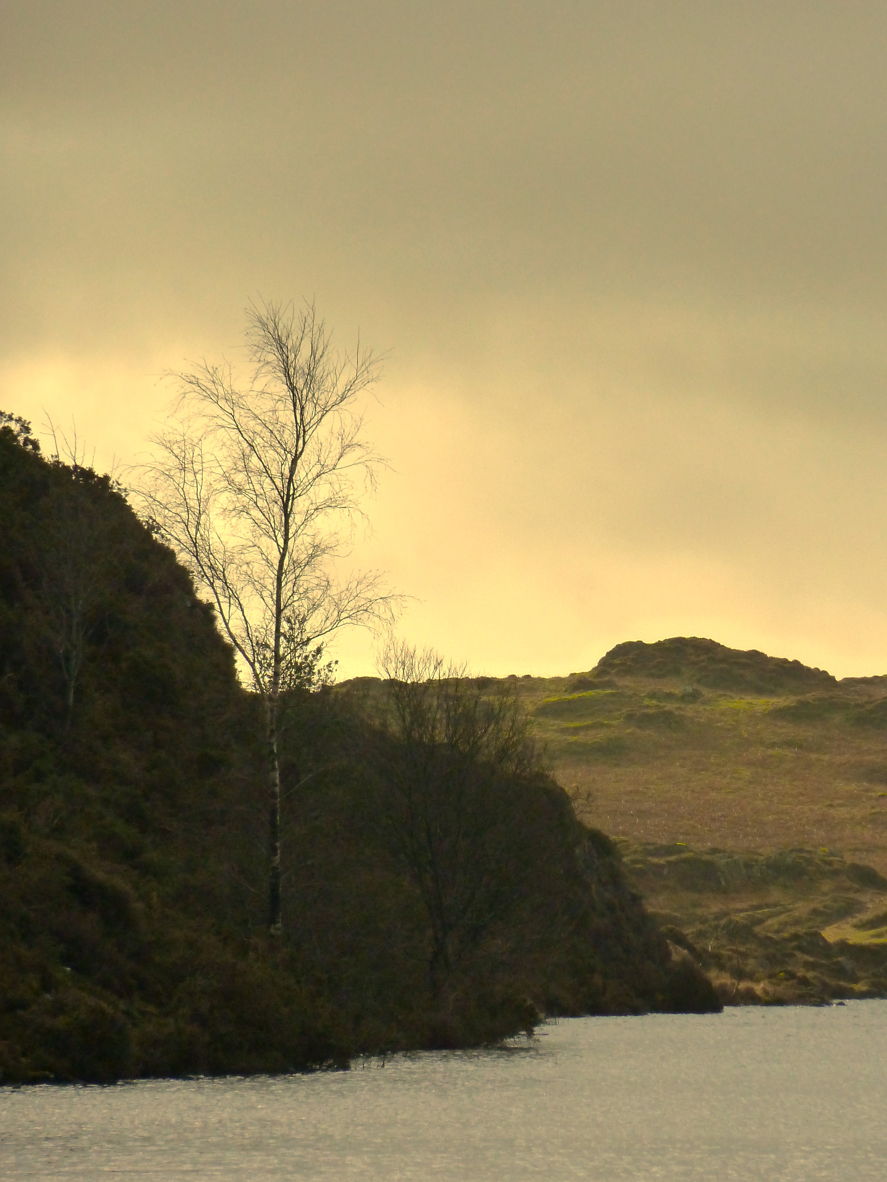
....passing Kentmere Tarn...
....and again
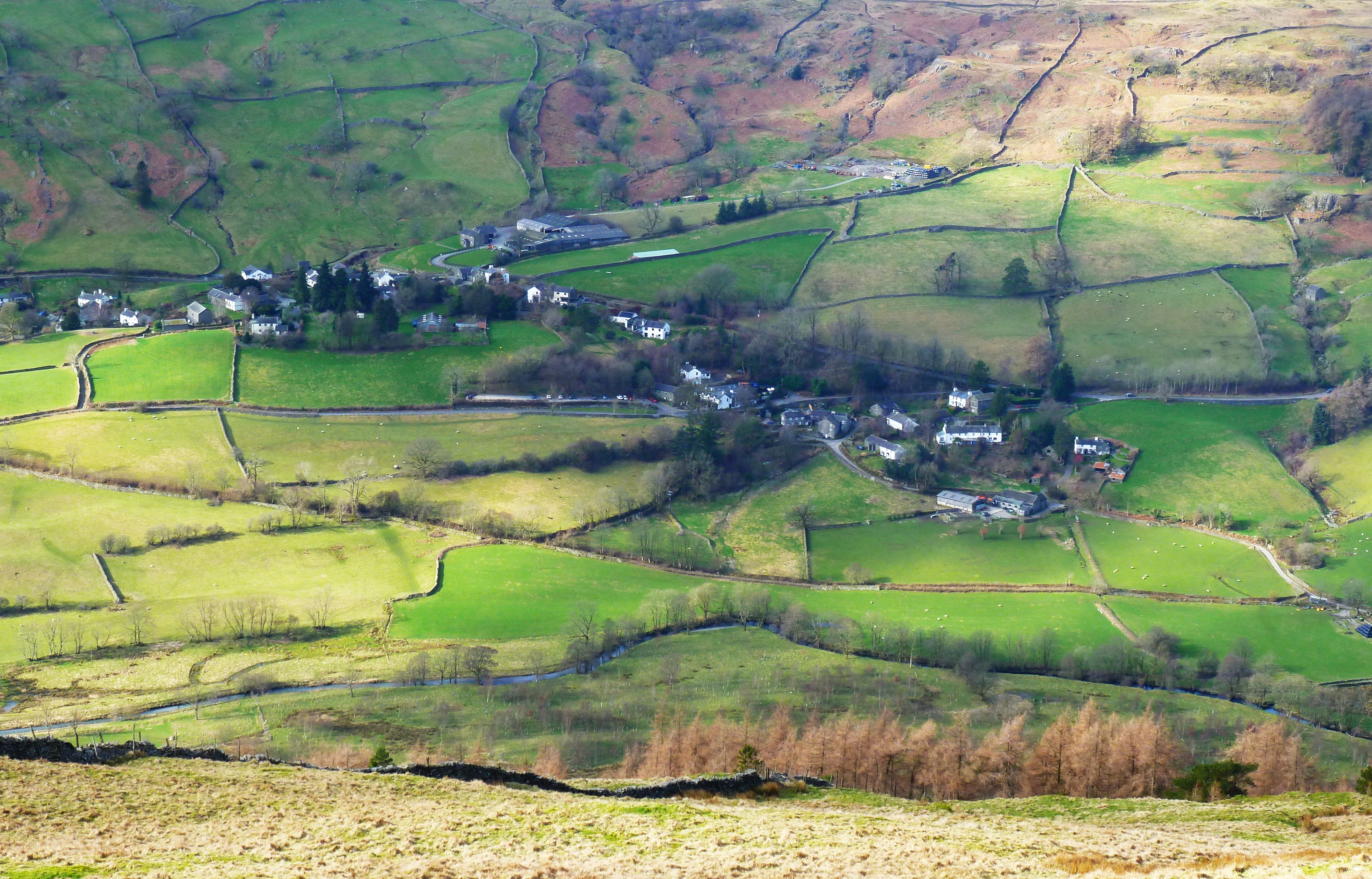
Kentmere village soon came into view
Zooming in on St Cuthbert's church in the village
Kentmere Hall with Piked Howes behind
After taking the Garburn Road track I branched off north to climb to Buck Crag.... 
....with a view from the summit to Rainsbarrow Crag and the ridge of Nan Bield Pass behind....
....and south to Morecambe bay
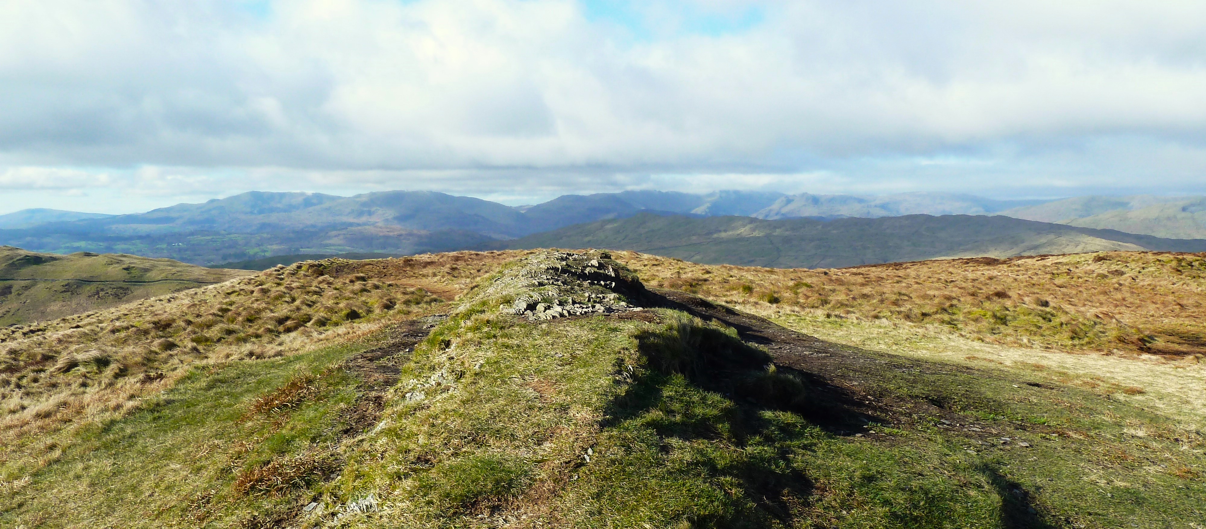
With the very strong cold wind at my back I walked south and soon arrived at Sallows summit cairn, looking to the Coniston fells....
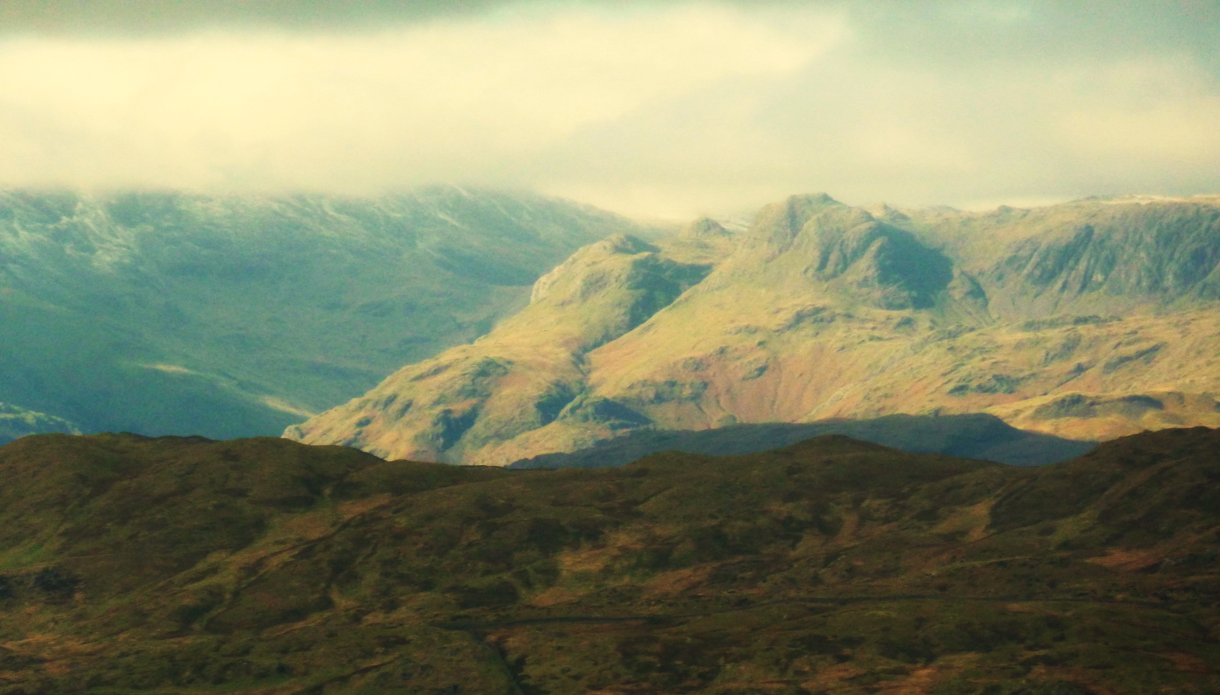
....and the Langdale Pikes and Bowfell in cloud
On the way to Sour Howes summit I had a view into the upper Troutbeck valley....
....and Troutbeck village from Sour Howes summit  
Windermere was now in view from the final descent...
....and Limefitt Park immediately below
Windermere again as I headed for Troutbeck Bridge and....
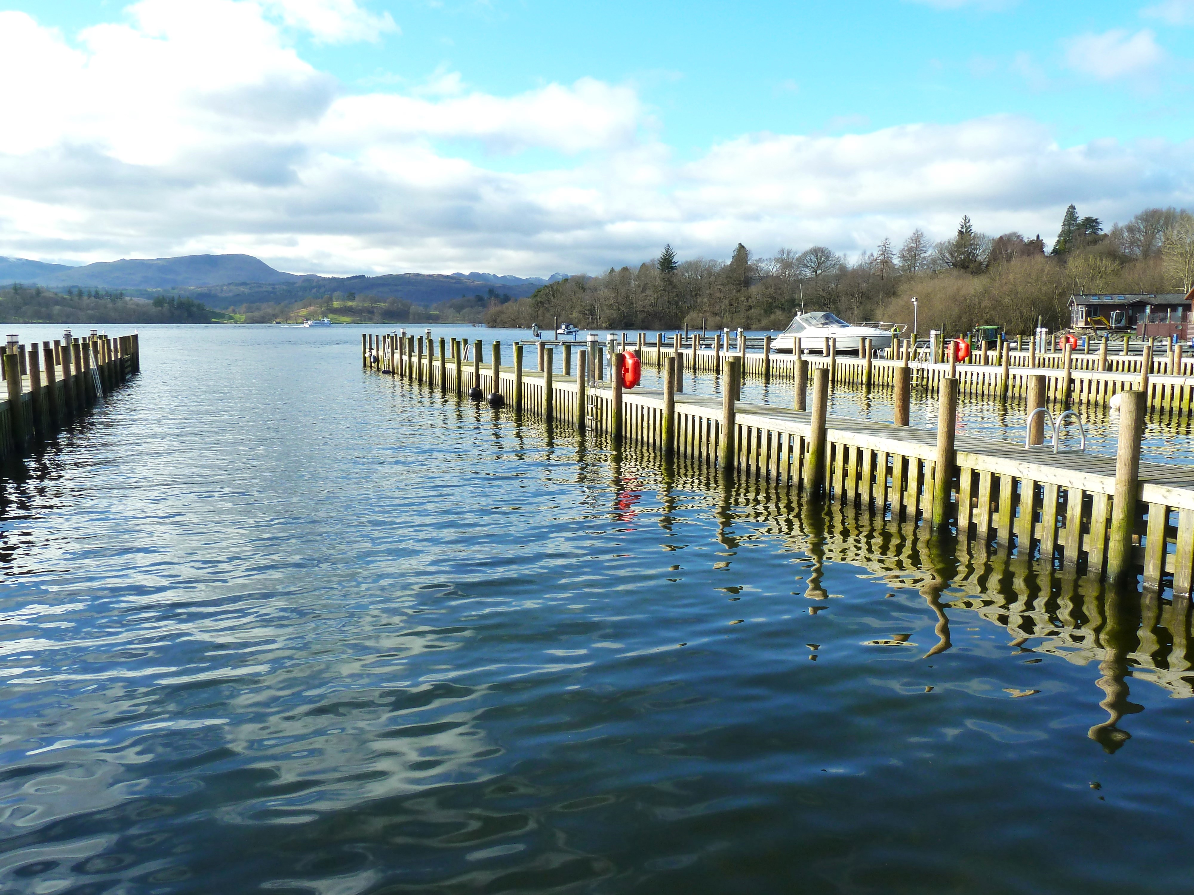
....finishing lakeside at White Cross Bay....
.....with a final view to Crinkle Crags, Bowfell and the Langdales with a dusting of snow.

My original plan for today was to start with Rainsbarrow Crag and Yoke, but as soon as I felt the strength of the bitter cold wind I decided instead to follow the route described above. It proved to be a wise decision and turned out to be a great day on the fells.


Tuesday 20 February 2024

 Torver to High Nibthwaite via Coniston Water, the Blawith fells & Beacon tarn

10miles 2300ft

Leaving Torver over the Common and past Kelly Hall tarn....
.....with a view south over Coniston Water before....
.....descending to the lakeside....

Sunny Bank ferry landing.....
....with a bench to sit and enjoy the view
After climbing away from the lake I followed the Cumbria Way path into the Blawith fells....
.....with Blawith fell or 'Beacon' as it's known, my first objective
Beacon summit cairn at just 836ft but with good views north to Wetherlam in cloud & the Yewdale fells in sunshine....and
.....a good view south to Beacon tarn and my next climb Blawith Knott on the far side
I rejoined the Cumbria Way around the tarn....
....with Blawith Knott in the distance
Looking back over the tarn to Beacon (fell)....
....before arriving at Blawith Knott summit cairn 814ft. 
I then did one more climb over Wool Knott....
....before my final descent to Greenholme....  
....with a stop for lunch by Greenholme beck
This carved plaque suggested that there was more water not to far away....
....and I was soon back on the side of Coniston Water at its southern tip
This boat house with its two lovely rowing boats was on private land in High Nibthwaite village but with a short public footpath to the lakeside....
.....where there was this life size sculptured figure very reminiscent of Anthony Gormley's 'Another Place' on Crosby beach...maybe he lives here and had one left over!!
A great day's walking in fine weather with good variety and interest without too much effort. 


Tuesday 13 February 2024

A Walk in the Howgill fells 

Cautley to Sedbergh via the river Rawthey, Arant Haw & Winder

10miles 2400ft

Setting off across the river Rawthey by the Cross Keys Temperance Inn at Cautley
Looking up the valley to Cautley Spout falls - but this was not my route today....
....after crossing Cautley beck....
....and zooming in on the falls....
I set off down the Rawthey valley towards Sedbergh
I passed through this farm yard with a clever way of opening the gate from the driver's seat of a vehicle, the string from the post to the right, when pulled lifted the latch and the gate swung open!
The path I was on forms part of Wainwright's 'A Pennine Journey' route
Some of the lower Howgill fells were now in sunshine but the higher ones behind were still in cloud
A break for morning coffee before leaving the river Rawthey and starting today's climb
Crook fell
Looking down to the river Rawthey
Standing at the col between Winder here....
....and Arant Haw summit today's highest point at 1985ft
The M6 motorway and the disused Lowgill railway viaduct in the Lune valley
Looking south back over Crook fell....
....and north again to the Lune valley....
....before descending back to Winder with the view to Sedbergh below....
Zooming in on Sedbergh school....
....before arriving in its Main Street!
The initial walk down the valley made a very pleasant start to a damp morning with low cloud on the summits.
It would have been good to have continued across the tops to 'The Calf' the highest in the Howgill fells at 2218ft but unfortuately time didn't permit this.