Wednesday 26 April 2023

Glenridding to Threlkeld

Via Ullswater,  Sheffield Pike, 'The Dodds' & Clough Head 12Miles 3700ft

Parking just north of Glenridding I set out along the side of Ullswater.....
....just as the sun rose over Place fell
Unfortunately it was a little too soon to take advantage of this bench!
Continuing towards Glenridding before....
.....starting the climb to Sheffield Pike
Looking down on Glenridding....
....and again with frost still lying on the ground at the head of the valley
The path known as 'The Rake' afforded some great views as here looking north up Ullswater
....and here looking again to Glenridding and the head of  Ullswater.....
.....before arriving on the summit of Sheffield Pike looking east to the pointed Catstye Cam with Helvellyn behind
....and again looking up Glenridding beck to Brown Cove 
It was now time to start the climb to 'The Dodds' forsaking the lower Sticks pass straight ahead I took the path to right climbing Stybarrow Dodd....
....from which there was a good view of Catstye Cam again with Swirrel Edge leading up to Helvellyn
My path then continued to Watson's Dodd & on to Great Dodd
Looking back to Stybarrow Dodd from Watson's Dodd....
....and down to Thirlmere below
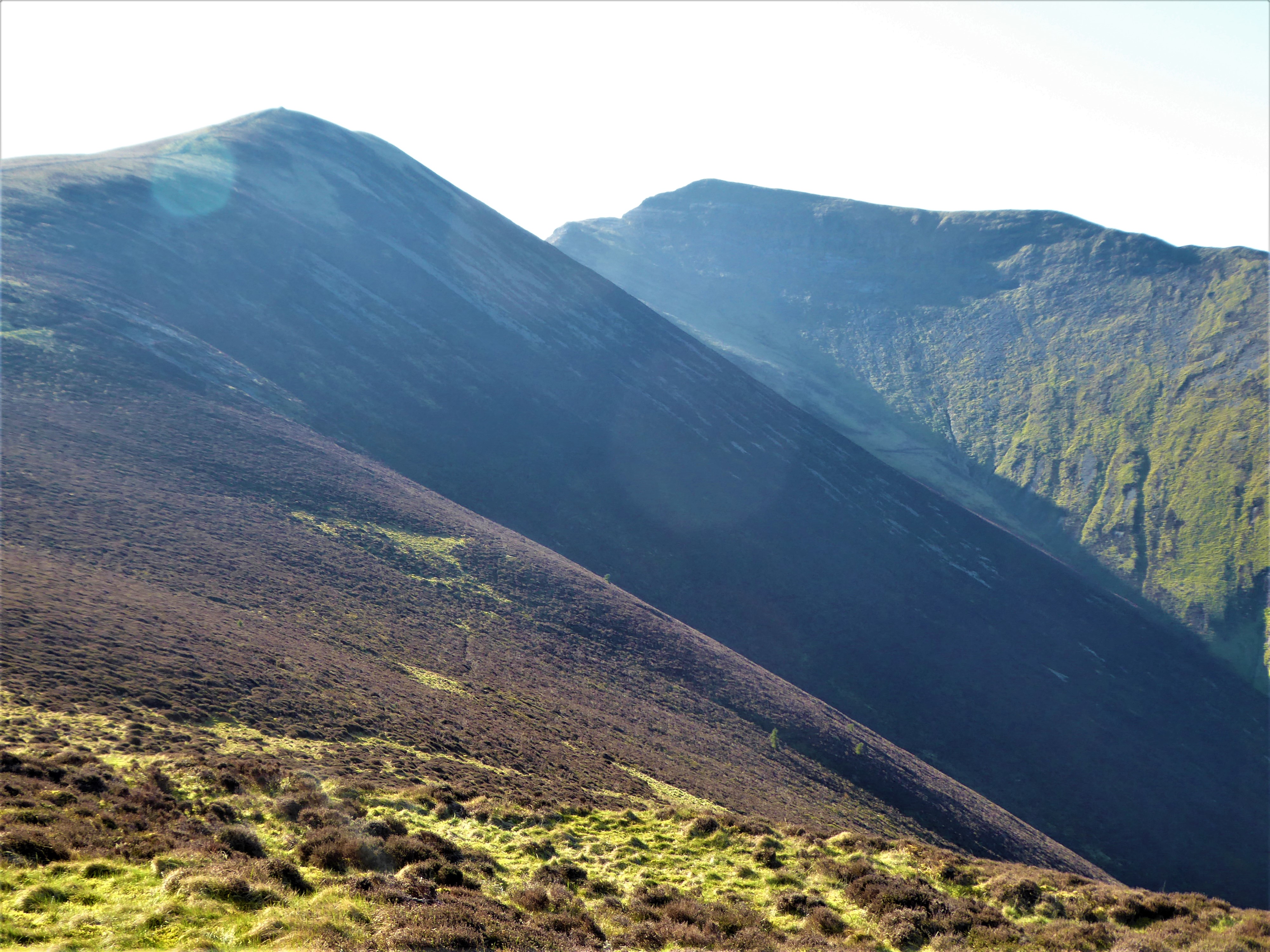
Now on Great Dodd which at 2812ft was today's highest point with a view to Keswick and Bassenthwaite 
The final summit of the day was Clough Head the northern most fell of  the Helvellyn range. I could now see my destination Threlkeld lying below Blencathra
A fine path lead down to.... 
                   the disused quarry tracks
 .....and the quarry which is now a growing tourist attraction with a steam railway using the existing rails. There is also an interesting museum.....
and many examples of outdated machinery
Finally I saw the little train but only with its diesel engine attached. I guess the steam engine is only used at certain times of the day. It was now just a short walk into Threlkeld village for my lift back to Ullswater.

A tough walk today but with good contrast between craggy and rounded fells after a very scenic start along the lakeside. Rounded off with a walk of some interest around the quarry and mining museum.


I've heard of a Partridge in a Pear tree but not a  Sparrow Hawk in an Apple tree in my garden! 


Wednesday 19 April 2023

 Swinside to Loweswater village 

Via Ladyside Pike, Hope Gill Head, Hobcarton Crag, Wandope, Whiteless Pike & the shore of Crummock Water. 11miles 3200ft

Setting off from Swinside above Lorton Vale on a perfect spring morning
Lorton Vale and the West Cumbrian coast after gaining height on the path to Ladyside Pike
Ladyside Pike with Hopegill Head now on the horizon
Following the ridge line to the summits....
....and looking back down the ridge from Ladyside Pike
Nearing the summit of Hopegill Head....
....and again
A gap in the ridge line known as 'The Notch'....
....and looking back to 'The Notch' having gained the summit 2526ft
Looking east to Grisedale Pike & Hobcarton Crag.... 
....and west down Gasgale Gill to Crummock Water
Hobcarton Gill from Hobcarton Crag
Hobcarton Gill leading down to the start of Whinlatter forest park
After turning south over Coledale Hause I arrived at Wandope summit 2533ft
Ridges and misty valleys looking east from the summit
Starting the descent over Whiteless Pike to Crummock Water....
....with a stop for lunch on Whiteless PikeThe final part of the descent down Rannerdale
Crossing Rannerdale beck....
....before arriving on the shore of Crummock Water
It was then just a lovely stroll along the lakeside in the warm spring sunshine to Loweswater village....
.....and again
A final rest for a coffee on the lake side before heading into the village for my lift back to the car.
I think this was just about as good as it ever gets for a day's walking in  Lakeland !


Wednesday 12 April 2023

A Circuit from Sadgill, Long Sleddale. 

Including: Shipman Knotts, Goat Scar, Kentmere Pike, Harter Fell & Gatesgarth Pass. 9miles 2700ft.

Setting off from the parking area by the bridge at Sadgill
Adjacent to the farm was a pasture with a very newly born lamb
Meanwhile the farmer came past me with fodder for the herd higher up the fells  
Looking up Longsleddale which would be my descent later in the day
The view looking south towards Morecambe bay after gaining height on Shipman Knotts
The summit cairn on Shipman Knotts....
....from where there is a view down the length of Long Sleddale. The dale is so named not because of its length but because of the longer than normal sleds that were used there to carry goods up and down the valley!
The next climb to Goat Scar was rewarded with this view to the head of the dale and Gatesgarth pass....
Zooming in on the zig zags in the path coming down from Gatesgarth as it passes the waterfalls 
Now at Kentmere pike summit where there had been snow falling over night at 2395ft
Looking ahead past the summit cairn to Harter fell in sunshine....
....and west to the dark outline of the Kentmere fells
After taking a slight detour I had a view down to Nan Bield pass (The pass of Anne's Shelter)  with Mardale Ill Bell and High Street behind
The Easter message was celebrated in the snow next to the path. 
Today's highest point the rather scruffy summit cairn on Harter fell 2552ft
Descending just a short distance off the path for the view to High Street with Blea tarn and Small water
Blea Tarn above....Small Water below..... 
Followed by the splendid view down the length of Haweswater
Zooming in on Mardale Head with its car park. The valley was flooded in 1935 to provide water for Manchester. The village of Mardale Green including a community of farmers' cottages, church and the Dun Bull Inn was lost under the water
The descent the took me down to the top of Gatesgarth pass and the route back down to Sadgill....
.....passing the waterfalls I had seen from above earlier in the day
Finally arriving back at my car at Sadgill bridge
Another superb day's walking with great views and some unexpected snow!